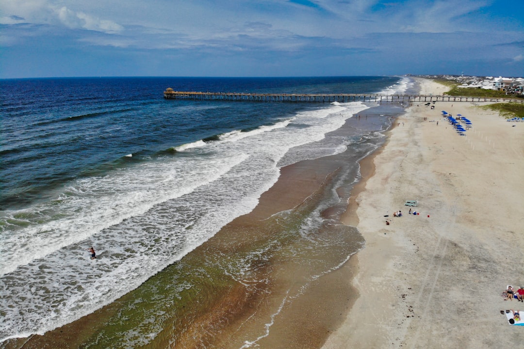
Cape Lookout National Seashore’s administrative mailing address is 131 Charles St, Harkers Island, NC 28531 — and that detail tells you something useful right away. The park’s operational center sits on Harkers Island, a small community connected to the mainland by a causeway, where waterfront and near-waterfront homes occasionally come to market. If you’re shopping in Beaufort, Harkers Island, or the Down East communities that face Core Sound, the National Seashore isn’t just a scenic backdrop. It shapes what you can build, how you get to the water, and what your neighbors’ land can ever become.
What the Seashore Actually Is — and Why It’s Different from a State Park
Cape Lookout National Seashore protects a chain of undeveloped barrier islands: North Core Banks, South Core Banks, and Shackleford Banks, stretching roughly 56 miles of coastline. The park is administered by the National Park Service, which means federal rules govern land use inside park boundaries. Those rules don’t expire with a state budget cycle, and they can’t be overridden by a county commissioner. The development that never happened there — no condos, no marinas, no paved roads — is a permanent condition, not a temporary one.
For a buyer looking across Core Sound toward the park, that permanence is one of the most valuable things you can have in a neighbor. The view, the quiet, and the undisturbed shoreline on the park side are structurally protected in a way that no private conservation easement fully replicates.
Access Is by Ferry, and That Shapes Everything
According to the National Park Service, reaching the barrier islands requires a boat — the NPS describes the seashore as “a boat ride three miles off-shore.” Ferry services provide transport to and from the islands, and the NPS maintains specific information on those operators. There are no bridges to North Core Banks, South Core Banks, or Shackleford Banks, and none are planned.
That ferry-dependent access has a direct practical effect on Harkers Island property: the island functions as a de facto gateway community. The Cape Lookout Visitor Center and ferry departure points draw recreational visitors, which in turn supports a modest local economy of outfitters, marinas, and seasonal businesses. A home on Harkers Island sits at the intersection of a working waterfront community and a federally protected wilderness corridor — not an amenity package that many coastal parcels can claim.
What access also means: if you’re buying on Harkers Island partly because you plan to use the park regularly, confirm the current ferry schedule and seasonal availability directly with the NPS (phone: 252-728-2250) before you assume year-round service at every landing.
Protected Species and What They Mean in Practice
The NPS explicitly identifies Cape Lookout as home to multiple protected species. The park’s own site names American Oystercatchers and four species of Loggerhead sea turtles as examples of species it monitors. The park designates beach Wildlife Protection Zones to manage human activity around nesting and foraging areas.
These protections matter to a buyer on the mainland or barrier island fringe for a specific reason: federal species protections don’t stop at the park boundary. If your property is near Core Sound, adjacent to tidal flats, or at the edge of a marsh — habitat types that connect directly to park ecosystems — any CAMA permit application, dock project, or shoreline modification you pursue will likely require a review that accounts for impacts to protected species. The further your parcel sits into the estuary system, the more relevant this becomes. If a dock or bulkhead project is part of your plan, the CAMA process for that kind of work deserves a careful look before you close. Getting a CAMA Permit for Emerald Isle Docks and Bulkheads walks through how that permit process generally works on the Crystal Coast, and the same framework applies in Carteret County broadly.
Dark Sky Status, ORV Permits, and Amenity Details Worth Knowing
Cape Lookout holds International Dark Sky Park designation, according to the NPS. That’s a formal certification — not marketing language — and it reflects the genuine lack of light pollution over the barrier islands and Core Sound at night. For buyers who care about that quality of life, it’s a checkable, durable fact rather than a listing agent’s description.
The NPS also requires an Off-Road Vehicle Beach Driving Permit before anyone drives on the barrier islands. If beach driving is part of how you plan to use the park, confirm current permit requirements and fees with the NPS directly — permit rules and associated costs can change with each season.
The two historical villages inside the park — Cape Village and Portsmouth Village — add a cultural dimension that draws a specific type of visitor: people interested in preserved coastal architecture and maritime history, not just beach recreation. That visitor profile tends to skew toward quieter use of the park, which has some bearing on the character of the communities adjacent to ferry access points.
Flood Zone and Insurance Realities for Core Sound Parcels
Nothing about the National Seashore insulates a nearby parcel from coastal insurance complexity. Beaufort and Harkers Island sit in an area where flood zone designations vary by parcel, and Core Sound-facing properties carry real exposure to wind-driven surge. The NPS’s presence doesn’t affect your property’s FEMA designation, your NFIP rate, or what a private wind insurer will charge.
Before making an offer on any waterfront or near-waterfront parcel near the seashore, pull the specific FEMA flood zone designation for that parcel on the Carteret County GIS system. Don’t rely on a neighbor’s zone or a listing sheet — confirm it for your parcel’s exact tax ID. The assumptions buyers make about wind coverage in particular deserve scrutiny; What Atlantic Beach Homeowners Should Ask Before Assuming covers the right questions to ask on that front, and the issues it raises are relevant across the Crystal Coast waterfront market.
Similarly, if any coastal infrastructure work — dredging, channel maintenance, or harbor projects — affects your planned access to open water, it’s worth understanding how those projects are coordinated at a regional level. How the Army Corps’ $1.3B Harbor Plan Affects Crystal Coast provides useful context on how federal agencies work alongside local communities on those questions.
Your Next Step Before Submitting an Offer
Call the Cape Lookout National Seashore directly at 252-728-2250 and ask two specific questions: first, whether the parcel you’re considering abuts or falls within any park boundary or buffer zone that might affect future development; second, which ferry operators currently serve the landing closest to the property and what their seasonal schedule looks like. Neither of those answers will appear on a listing sheet, and both have real bearing on what you’re buying.
Then pull the Carteret County parcel record and verify the flood zone independently before your due-diligence window closes.